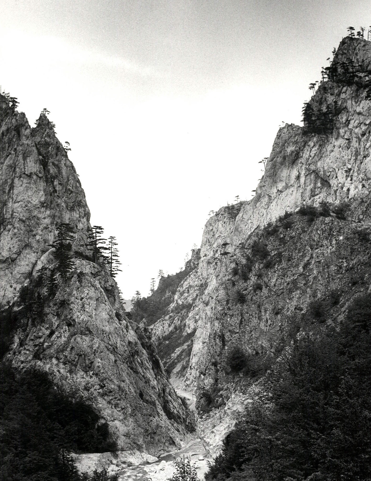
The Sutjeska Canyon – the Town of Vratar
The Sutjeska Canyon – the Town of Vratar
Sutjeska or a gorge, a narrow and deep valley with steep, rocky sides
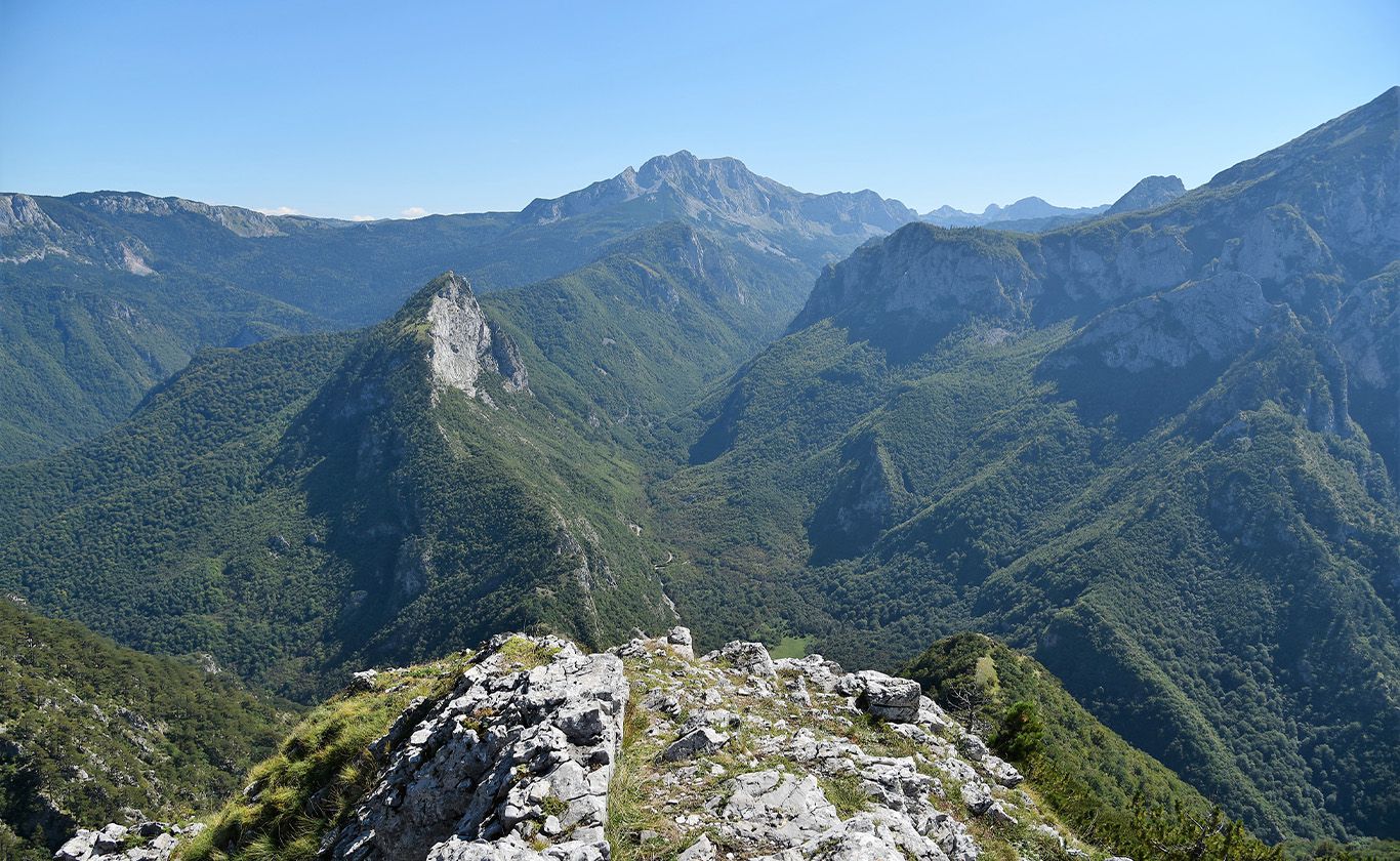
On the territory of National Park ‘Sutjeska’ there is a well developed network of watercourses and standing water, the main basin being that of the river Sutjeska. The Sutjeska River is a 33-kilometer long river that starts at an elevation of 1800 m, on the border of Bosnia and Herzegovina and Montenegro, in the mountain massifs of Volujak (2336 m) and Vilište (2133 m), on the southeast slopes of M. Vlasulja (1992 m) and the west slopes of Kuk (1821 m) in the hills. Its confluence with the Drina is at 430 mamsl. Thus, the fall is 1370 m, which tells a lot about the character of that noisy, mountain beauty. The Sutjeska River flows through the entire area of Tjentište, the central part of the Park.
Cold and extremely clean water of the Sutjeska is an ideal home to salmonid fish: trout and grayling, which, together with its idyllic ambience, makes it a paradise for sportfishing.
The main tributaries of the Sutjeska are: Jabučnica, Hrčavka, and Bukovik in the west, Suški potok, Perućica, and Ždrijelo in the east. All of the rivers in the Park are crystal clear and clean, rich in brown trout and other forms of life characteristic of these ecosystems. The most important right tributaries of the Sutjeska are Suški potok and Perućica. The source of Suški potok is located at an elevation of about 1310 meters, at the bottom of the valley between Maglić and Volujak. This small river with steep banks flows through limestone landscapes with frequent cascades, rapids and waterfalls. Perućica receives springs on Crvene prljage at about 1600 meters above sea level. For 6.5 km it flows through a magnificent landscape of the primeval forest Perućica, and in the middle part of its watercourse called Skakavci, 3 km away from its source, it forms a 70-meter high waterfall. Hrčavka is the left tributary of the Sutjeska and originates from Zelengora, between Ljubin Grob and Planika, at 1570 meters. The length of this river is 13.5 kilometers and its unusually cold water flows through a picturesque canyon, full of cascades and stone pools. It is possible to organize canyoning through a part of the Hrčavka canyon, and the Sutjeska canyon is suitable for kayaking.
The town of Vratar is located 8 kilometers away from the Administrative Center of National Park Sutjeska, upstream from the Sutjeska River, on the road from Tjentište to Gacko. Vratar, often called Sutiska (or Sutjeska) is located on the narrowest part of the gorge of the Sutjeska, and it represents an upgrade of the natural ‘gate’ located on the slopes of the mountain massifs of Volujak and Zelengora. The most vivid representation of this place from the time when photography did not exist is a description of Vratar as a place where two mountains stretched their hands towards each other, but were separated by the Sutjeska River. It is often said that Vratar is the natural border between Bosnia and Herzegovina. The historical importance of this site is in the fact that the fortification was located on a very important route “Via Drina” which connected Dubrovnik and Foča, and went further to the area of medieval Serbia. Due to its strategic position, Vratar was a customs town for all merchants and travelers from Dubrovnik who used this route. Today, the remains of the medieval town are quite plain and only a shadow of the former fortification, which played a major role in the busy caravan route.
Numerous legends about the town of Vratar and the period when Herceg Šćepan ruled, remained a tradition for the people who inhabited the area of Tjentište. One of the most well-known legends is the one about the existence of the huge rings (big metal hoops). It is said that the chain which Herceg Šćepan used to block the Sutjeska Canyon was tied to these rings. According to the legend of the area, the rings were attached to the rocks, and between them there was a massive chain which blocked the way for the unwanted visitors.
Vratar flourished during the time of Herceg Šćepan Kosača, the most important person of medieval Herzegovina, when this whole area was in its ‘golden age.’ The fortified town of Vratar was leaned on the parish Tjentište, where a caravan station was formed in the mid fifteenth century. The name Tjentište was derived from the Latin word for tent ‘tent,’ so this area was populated from the period of the Roman Empire. Nowadays, The Battle of Sutjeska Memorial Complex and the Hotel Mladost with its accompanying facilities are located on the site where trade caravans once rested. In the Middle Ages, the town of Vratar experienced its most significant rise, but in the same period it reached its end. The customs house ceased to exist with the arrival of the Ottomans, when the function of the town changed and gradually ceased to exist. Although the fortification of Vratar was at its best 500 years ago, you can still feel the connection between the past and the present here. In spite of the progress in construction and technology, the old caravan road and today’s modern highway are located at the same place, and the caravan resort on Tjentište is today a modern vacation spot with a hotel, campsite and sports fields. The town of Vratar continues to live, once as an important town of the Kosača family, today as a tourist attraction and part of traditions and legends.